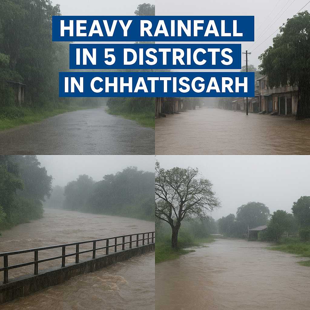
Chhattisgarh weather alert :The IMD has issued red alerts for five districts in Chhattisgarh for October 28, 2025, with a risk of very heavy to extremely heavy rain. Expect intense showers in short bursts, along with thunder and gusty winds. This post explains which districts face the highest risk today, why the rainy season has returned late in October, and quick safety steps you can use right now.
Table of Contents
Stay calm, stay informed, and keep your plans flexible.
IMD red alert in five districts today: where and when heavy rain will hit
Chhattisgarh weather alert:IMD expects isolated extremely heavy rain of around 21 cm or more today, October 28. Thunderstorms, lightning, and gusty winds up to 70 km/h are likely in parts of the state. These conditions can cause urban flooding, waterlogging, traffic delays, and power cuts. Drain levels can spike fast during intense spells.
The highest risk zone sits over northern and eastern districts, where moisture bands look thicker and more persistent. For official live warnings, see IMD’s state page for Chhattisgarh under Sub-Divisionwise Warnings, which is updated frequently: IMD Chhattisgarh warnings. IMD’s national warning also flags extremely heavy rain potential today: All India weather warning PDF.
Which Chhattisgarh districts face the highest risk today
The belt most likely to be hit based on recent patterns: Balrampur, Jashpur, Bilaspur, Korba, Raigarh, Sarangarh-Bilaigarh, Surajpur, and Surguja. Five of these are under red alert as per the latest IMD state bulletin. For the exact district list and late changes, check the IMD portal and state advisories throughout the day.
What a red alert means for you
Red alert means take action now. Prepare for flooding, follow official instructions, and stay ready to move to safer ground if advised. Likely effects include localized floods, road closures, tree fall, lightning risk, power outages, and school or travel disruptions. Stay indoors during peak rain, avoid low-lying areas, and keep emergency numbers ready.
Chhattisgarh weather alert next 24 to 48 hours: timeline and what to expect
The most intense rain is expected today, October 28. Some relief may follow, but thunderstorms and lightning can continue in pockets. Rivers, streams, and drains may rise quickly, even after heavy showers pass. Stay alert near slopes, culverts, and water bodies.
Why has the rainy season returned in late October 2025?
Chhattisgarh Weather Alert: Three drivers are at play. A depression over the east-central Arabian Sea, a low over the southeast Bay of Bengal likely strengthening into a severe cyclonic storm around October 28, and a fresh western disturbance are interacting. Moisture from both the Bay and the Arabian Sea is feeding thick cloud bands over central India. Monsoon withdrawal has been delayed this year, so rain-bearing winds stayed active and several places ended up with above-normal totals.
IMD’s latest cyclone update offers context on the evolving system over the Bay, including track and intensity guidance: IMD press note on Cyclonic Storm Montha.
Two seas feeding moisture into Chhattisgarh
Winds are pulling moist air from the Bay of Bengal and the Arabian Sea. When these streams meet over central India, tall clouds grow fast, and heavy rain follows.
Western disturbance adds a trigger
A western disturbance is a moving weather system from the west that crosses the Himalayas. It helps lift moist air, which boosts thunderstorms and can intensify downpours.
Monsoon lingered longer this year
Monsoon did not retreat fully by early October, so showers stayed active. Northern districts, including parts of Balrampur, saw above-normal totals as moisture kept arriving.
Safety, travel, and farming tips during heavy rain
Treat a red alert like a checklist. Prepare your home, plan travel only if needed, and protect fields and stores. Follow district updates, and act early.
- Keep devices charged, secure documents, and move valuables up.
- Delay non-urgent trips. Share your location if you must travel.
- Farmers, protect seed and grain. Improve drainage where safe.
Quick home safety checklist
Chhattisgarh Weather Alert: Charge phones and power banks. Move valuables to higher shelves. Keep a first-aid kit and clean water. Turn off the main power if water enters. Avoid using metal items during lightning. Keep kids and elders indoors. Keep emergency contacts handy.
Travel and school plans
Do not cross flooded roads, even if water looks shallow. Allow extra time for trains and buses. Park away from trees and power lines. Follow district and school notices on closures. Use only official weather apps and alerts.Farm and village guidance
If safe, clear channels to drain standing water from fields. Protect stored grain and seeds from moisture. Move livestock to higher ground and dry shelters. Boil or filter drinking water. Watch for snakebite risks after flooding.
Conclusion
Chhattisgarh Weather Alert: Five districts are under red alert today, with the worst rain likely on October 28 due to multiple systems and a late monsoon retreat. Keep plans flexible, avoid risky travel, and follow IMD and local authorities for updates. Help neighbors who might need support. Stay safe, stay prepared, and check official alerts through the day.